Saturday, January 31, 2015
Keibul Lamjao National Park, Manipur
About Keibul Lamjao National Park in Manipur
Keibul Lamjao National Park is located at about 48 kilometers away from Imphal, in the Bishnupur district of Manipur state in north eastern India. The National Park is about 40 square kilometers in area and is the only floating park in the whole world. The Keibul Lamjao National Park forms an integral part of Loktak Lake of Manipur. The greenery of the area and the moderate climate in the Park makes it a pleasant surprise and an interesting option for a family vacation.
Loktak Lake is a fresh water lake, also called as the floating lake because of the floating decomposed plant materials called phumdis in the local language. As this National Park is the natural refuge of the endangered Manipur Eld's Deer / Brow antlered Deer and Sangai also known as the Dancing Deer, this was declared as a Sanctuary in the year 1966. Later the Sanctuary got declared as the National Park in 1977.
The National Park is a swamp which was established by Mann Sharma with floating mass of vegetation. More than two thirds of the park area is formed by Phumdis . There is a water way which passes through the park gives you access through out the year . Boats plying through the lake to the Pabot Hill in the north of the Keibul Lamjao National Park. The swamp which forms the National Park contains three hills namely Pabot, Toya and Chingjao. During monsoon season these hills give refuge to the large mammals.
Apart from the Brow antlered deer there are many other species which are found here some of them are , Hog Deer, Wild boar, Jungle cat, Fox, Bamboo Rat, flying fox, Sambar Musk shrew etc. You can also find amphibians and reptiles like Viper, Krait, Cobra, Asian Rat snake, python,Tortoise and many more. You can also find bird species in this park like Kingfisher, Hill Mynah, North Indian Black Drongos, Indian White-breasted Water hen and Crimson-breasted pied wood pecker and many more.
How to reach Keibul Lamjao National Park?
Imphal, the capital city of Manipur, is the nearest airport. The airport is connected with New Delhi, Kolkata and Guwahati. These three airports are connected with almost all the cities in India. The Imphal airport is placed at the heart of the city and you can easily get cabs to reach the National Park.
Nagaland and Manipur State transport buses operate from the towns of Aizwal, Dimapur, Itanagar, Kohima, Shillong and Agartala to the National Park. These buses ply every day and the tariff per seat is Rs 75 to Rs 250. The travel in a bus from Dimapur to Imphal requires approximately 8 hours.
Imphal does not have a railway station. The nearest one to Manipur is at Dimapur which is located at about 215 kilometers and will take about 8 hours of bus journey to reach Imphal. Guwahati , is the next railway station and is located at about 414 kilometers from Imphal.
Trains to Guwahati are available from various parts of India namely, Kanyakumari , Thiruvananthapuram, Bangalore, Hyderabad, Chennai, New Delhi etc.
About Chandigarh
Chandigarh is one of the 7 union territories in India and is located at the northern part of the country. The city serves as the capital city for both Punjab and Haryana statesbut the city is ruled by the union government and not by either of the two states.
Chandigarh is located at the foothills of the Shivalik ranges of the Great Himalayas. The city has an area of 114 sq kilometers and placed at an altitude of 321 meters above sea level.
Chandigarh is a well planned city with pretty gardens and well laid roads and is well known for its design and architecture. The name Chandigarh was derived from the name of the Goddess Chandi who is the presiding deity at the Chandi Mandhir in Panchkuta district.
How to get to Chandigarh?
Chandigarh is well connected by air, rail and by roads.
The airport is located at about 12 kilometers from the centre of the city.
There are two daily run trains connect Delhi and Chandigarh, Shatapthi and Himalayan Queen.
If you are travelling by road, there are two national highways No 21 from Ambala to Kinnaur, No 22 from Chandigarh to Leh connect the city with the Indian network of roads.
Places to visit in Chandigarh
There are Sukhna Lake, Rock Garden, Rose Garden, Leisure valley, Government Museum and Art Gallery, Musical fountain and many more places to visit in Chandigarh.
Friday, January 30, 2015
National Tiger Reserves in India
Bandipur Tiger Reserve - Karnataka
Buxa Tiger Reserve - West Bengal
Corbett Tiger Reserve - Uttarkhand
Kanha Tiger Reserve - Madhya Pradesh
Manas Tiger Reserve - Assam
Melaghat Tiger Reserve - Maharashtra
Palamau Tiger Reserve - Jharkhand
Periyar Tiger Reserve - Kerala
Ranthambore Tiger Reserve - Rajasthan
Sariska Tiger Reserve - Rajasthan
Simlipal Tiger Reserve - Orissa
Sunderbans Tiger Reserve - WestBengal
Indravati Tiger Reserve - Chhattisgarh
Nagarjunasagar Tiger Reserve part - Andhra Pradesh
Ngarjunasagar Tiger Reserve part - Telengana
Namdapha Tiger Reserve, Arunachal Pradesh
Dudhwa Tiger Reserve - Uttar Pradesh
Kalakkad - Mundanthurai Tiger Reserve - Tamil Nadu
Valmiki Tiger Reserve - Bihar
Pench Tiger Reserve - Madhya Pradesh
Pench Tiger Reserve - Maharashtra
Tadoba Andheri Tiger Reserve - Maharashtra
Bandhavgarh Tiger Reserve - Madhya Pradesh
Panna Tiger Reserve - Madhya Pradesh
Dampa Tiger Reserve - Mizoram
Bhadra Tiger Reserve - Karnataka
Pakke Tiger Reserve - Arunachal Pradesh
Nameri Tiger Reserve - Assam
Satpura Tiger Reserve - Madhya Pradesh
Anamalai ( Indira Gandhi) Tiger Reserve - Tamil Nadu
Udanti - Sitanadi Tiger Reserve- Chhattisgarh
Satkosia Tiger Reserve - Orissa
Kaziranga Tiger Reserve - Assam
Achanakmar Tiger Reserve - Chhattisgarh
Dandeli- Anshi Tiger Reserve - Karnataka
Sanjay Dubri Tiger Reserve - Madhya Pradesh
Mudumalai Tiger Reserve - Tamil Nadu
Nagahole ( Rajiv Gandhi ) Tiger Reserve - Karnataka
Parambikulam Tiger Reserve - Kerala
Sahyadri Tiger Reserve - Maharashtra
Pilibhit Tiger Reserve - UttarPradesh
Biligiri Ranganatha Temple Sanctuary - Karnataka
Kawal Tiger Reserve - Telegana
Mukundra Hills - Rajasthan
Bor Tiger Reserve - Maharashtra
Nawegaon-Nagzira Tiger Reserve - Maharashtra
Kudremukh
Satyamangalam - Tamil Nadu
Yelagiri, a trekkers destination in Tamil Nadu
Yelagiri is a popular hill station in the state of Tamil Nadu located on the Vaniambadi - Thirpattur road, surrounded by orchards, rose-gardens, and green valleys.
Yelagiri hills is known for its salubrious climate throughout the year with an altitude of about 1410.6 meters above sea level.
Tourists throng the place for trekkings. Swamimalai hill in Yelagiri is a well known destination for trekkers. In Yelagiri there are 14 small villages and many temples on the various hills of the region.
The highest point in Yelagiri is the Swamimalai hills standing at about 4338 feet. There is a Murugan Koil in the hills and view from the summit is very beautiful.
How to reach Yelagiri?
Yelagiri hills are well connected by road from Chennai and Bangalore.
Chennai and Bangalore international airports and Thituchirapalli domestic airport are the nearest airports to reach Yelagiri.
Jolarpettai Junction is the nearest railway junction at about 20 kilometers from Yelagiri. You can get buses / taxis from the station to reach Yelagiri. Buses are also available from Thiruppattur, Salem and Hosur.
By Road
From Chennai you can travel via Sriperumbudur, Vellore, Ambur, Vaniambadi on the Chennai Bangalore highway.
From Bangalore you can travel via NH 7, by the hosur road towards Krishnagiri.
While you drive by road there are 14 hairpin bends on the ghat section to Yelagiri.
Contact for more details
Forest Range Office - 04179 220185
Accommodation facilities in and around Yelagiri
Hotel Landmark
Boat House Road, Athanavur,
Opp: Murugan Temple,
Yelagiri Hills,
Tamil Nadu 635853
For Bookings:
Mobile : 9884608071 / 9444990325
Email: hlmyelagiri@gmail.com
Website: www.landmarkyelagiri.com
Yelagiri Hills Country Club
For Bookings, call - 04179-245290/ 04179-245457
Chariot Valley - 08939844511 / 04179245301
Kumararaja Palace - 04179 245325
Emerald Dove - 04179 245264
Madhura Resort - 09840544894
PWD IB - 04179 245222
YMCA Dormitories - 245226
Hotel O Nila- 04179 245371
Taj Gardens - 04179-245231/245445 /08423-245231
Namdapha Wildlife Sanctuary, Arunachal Pradesh
About Namdapha Wildlife Sanctuary
Namdapha Wildlife Sanctuary has been declared Namdapha National Park and Tiger Reserve in the year 1983 by the Government of India. This Sanctuary has a nature of true wilderness and a captivating beauty with lush green vegetation as well as impenetrable pristine and virgin forests. The National park covers an area of 1985 square kilometers and has various varieties of flora and fauna. This National Park and a Tiger Reserve lies at the international border between India and Myanmar, but within the Changlang District of Arunachal Pradesh, one of the seven states in the northeastern parts of India.
Namdapha National Park has the richest diversity maybe in the whole of Indian sub continent since it has the great altitudinal variations one could find that is from 4500 meters at Daphabum which is the highest to the 200 meters in the lowest of valleys.
Noa Dehing, Deban and the Namdapha are the rivers flowing in the area and you can see tropical rainforests in the valleys, with huge Hollock, Hollong and Mekal trees along with giant creepers namely, tall and dense Cane and Bamboo. There are deciduous forests and alpine forests in the higher regions which shows tht Namdapha is a botanical haven.
There are more than 150 tree species, flowers and orchids in the National Park. Blue vanda one of the rarest of Orchid species can be seen here
Tourist attractions in and around Namdapha Firm base, located at about 25 kilometers from the Deban Forest Lodge, on the Noa Dehing river, is a popular camping site. The base camp is nestled amidst beautiful and spectacular natures splendours. The track leads to an idyllic spot whih is surrounded by dense and luxurious forests. You can see birds of various species as well as some of the wild animals on the way to the camp. All the necessary equipments and guides are provided by the forest department for camping in the area.
Deban is a beautiful forest camp which is located on the bank of the river Noa Dehing and is placed within the boundary of the Namdapha National park. The place is ideal for trekking, hiking and angling on the river Noa Dehing. The forest bungalow is surrounded by evergreen forest is a place worth staying. It will be n experience you will find memorable.
Hornbill located at about9 kilometers from Deban is the homing ground for the hornbills . You can see lots and lots of these birds flying from one place to the other.
Camera Point is a camping site which offers you a vantage point for taking photographs of the wonderful and breathtaking views of the Namdapha landscape.
Gandhigram, located at about 120 kilometers from Deban, is placed on the southeast periphery of the National Park Namdapha. This is the last village in India which is wedged between China and Myanmar. This is also the home of the Lisu / Yobin tribe. Those who are interested in trekkng can try out a week long trek through these lush and dense jungles.
How to reach Namdapha National Park?
Dibrugarh is the nearest airport and Tinsukia is the nearest Railway station. Buses ply from from Dibrugarh to Miao regularly via Tinsukia, Margherita, Ledo, Jagun and Kharsang. Miao is an attractive little township on the banks of the river Dehing in the Changlang district of the state of Arunachal Pradesh. Miao town is the entry point for the Namdapha National Park, which is about 160 kilometers from Dibrugarh.
By Air
Nearest Airport is located at Mohanbari in Dibrugarh of the state of Assam which is about 182 kilometers from The Forest Rest House in Deban, within the Namdapha National Park area.
By Rail
The nearest main Railway station is Tinsukia, in the state of Assam, 141 kilometers from Forest Rest House, Deban, which is located within the Namdapha National Park area and the nearest Passenger Railway station is Margherita Railway Station in Assam at about 91 kilometers from Forest Rest House, Deban.
By Road
You can find good and motorable road connecting other towns and cities with the town Miao, which is entry point of the Namdapha National Park. The Forest Rest House, Deban is located within the Namdapha National Park area and is about 186 kilometers away from Dibrugarh, 141 kilometers away from Tinsukia, 91 kilometers from Margherita and 136 kilometers from the district headquarter Changlang.
The best way to reach Miao and then to Deban will be by Jeeps and Gypsies as it would be better to have your own vehicle to go to Namdapha. Taxis and other private cabs might prove very costly for the trip.
The best time to visit Namdapha National Park and the Tiger Reserve will be October to April that is after the North east monsoon season.
Languages spoken and understood in the surrounding areas are Tangsa, Singpho, Assamese, Hindi and English.
Indravati National Park, Chhattisgarh
About Indravati National Park
Indravathi National is the one and only Tiger Reserve and is located in the Dantewada district of Chhattisgarh, in India. The park gets its name Indravathi from the river Indravathi which flows flowing from east to west forms the northern boundary of the park with the state of Maharashtra .
The area of the park is approximately 2800 square kilometers. The Indravathi park was declared a National park in 1981 and a Tiger Reserve in 1983. After the park was declared as a tiger reserve under the Project Tiger of India , it became one of the most famous tiger reserves of India
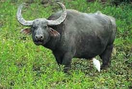
The altitude of the Park is from 177 to 599 m above the sea level and it has become famous for its unique and diverse wildlife and bird species including some of the most endangered species such as Wild Buffalos and Hill Mynas.
Beautiful hill ranges with lush green vegetation and unique and varied wildlife makes the park " a must see " for a tourist and a wild life enthusiast.
Flora and fauna of the National Park
The major wildlife in Indravati National Park include the endangered Wild Buffalos, Barasinghas, Tigers, Leopards, Gaurs (Indian Bison), Nilgai, Sambar, Chausingha (four-horned Antelope), Sloth Bear, Dhole (Wild Dog), Striped Hyena, Muntjac, Wild Boar, Flying Squirrel, Porcupine, Pangolins, Monkeys and Langurs among many others. The commonly found reptiles in the park are Freshwater Crocodile, Monitor Lizard, Indian Chameleon, Common Krait, Indian Rock Python, Cobra and Russell's Viper to name a few. The Park also gives shelter to the large variety of birds of which Hill Maina is the most important species here.
How to Reach the Park?
By Air: Raipur is the nearest Airport which is 486 kilometers away and the railway station is Jagdalpur which is 168 kilometers away.The Village Kutrue is the entry point to the Indravathi national park and the link road is situated at a distance of 146 kms kilometers from jagdalpur on the jagdalpur - Bhopalpattinam Road. From the Village Kutrue it is still 22- 23 kilomters to reach the park. It would be betterif you can hire a car from the railway station at Jagdalpur.
By rail: The nearest railway station will be Jagdalpur which is the district headquarters.
The nearest bus stand for Indravati National Park is Bijapur and the town is well connected from different parts of the state.
Best time to visit the National Park:
You can visit the park at any time of the year, but would be better to avoid the rainy days of the North east Monsoon and southwest monsoons. As such December to June will be the best time to visit the place.
Thursday, January 29, 2015
Papikonda Wildlife Sanctuary
Papikonda Wildlife Sanctuary, located in the state of Andhra
Pradesh, is one of the well known tourist destinations, where one can
enjoy nature and the wildlife at the same time.
Papikonda
Wildlife Sanctuary has an area of 591 square kilometers and was
established in the year 1978. located at about 50 kilometers from
Rajahmundry in the district of Khammam of the state of Andhra Pradesh.
The Papikonda Wildlife Sanctuary represents the tropical forest on the
eastern ghats of the India.
You can find a wide variety of
plants and shrubs grow and that make the vegetation of the place rich
and vibrant, other than the fauna in the park.
Trees like
Tectona grandis, Tominalias, Tomentosa, Lagerstroemis Lanceolata,
Albizzia and others are found in the park. Other than Tigers and
Leopards one can find Spotted Deer, Antelopes, Sambar, Hyena, Sloth
Bear, Muggers and Gharials.
The Wildlife Sanctuary has an
environmental education center and Museum located inside to develop the
interest and taste for wildlife among the students and the other
visitors . Safaris and river trips are arranged regularly on the river
Godavari.
The months after monsoon that is from November to June will be the best time to visit the wildlife Sanctuary.
How to Reach Papikonda Wildlife Sanctuary?
Hyderabad
will be the nearest international airport to reach the Sanctuary. From
there you can get cabs, trains and buses to reach Rajahmundhry which is
about 50 kilometers away from the Park.
Rajahmundry is the
nearest railway station. Tourists can reach the sanctuary by road as it
is just about 50 kilometers away from Rajahmundry.
From Rajamundhry local jeeps, buses or rented cabs are the options that one can use to reach the Sanctuary.
Accommodation Facilities in and around the Papikonda Wildlife Sanctuary.
Forest
rest house at Rajamundry is the nearest accommodation facility near the
forest area. You can also stay in Rajamundhry and drive to the wildlife
sanctuary as a day excursion.
Other tourist destinations like
Maredumilli and Kannapuram have few guest houses that provide the
overnight stay facilities to the visitors.
Some of the hotels in Rajahmundhry are
River Bay
KEI, RajaMahendhri ResortPLtd
5-1-36to 43, River Bay oad,Near Gouthami Ghat
Rajahmundhy, Andhra Pradesh - 533101
TEl : 91 883 2447000
Fax : 91 883 2447006
EMail : fom@riverbay.co.in
Website: http://www.riverbay.co.in/
2. Anand Regency Hotel
26-3-7, Jampet
Rajahmundry, Andhra Pradesh,
Pincode- 533103
Phones: 0883 2461201
Email : info@hotelanandregency.com
Url: http://www.hotelanandregency.com
Tuesday, January 27, 2015
About Bihar
Bihar is one of the 29 states and is located in the eastern part of India. The states boundaries are
West bengal in the East, Uttar Pradesh in the west, Nepal in the north
and Jharkhand in the south. Ganges river flows west to east through
the middle of the state of Bihar, dividing the state in to two parts.
Bihar
has a vast stretch of Fertile plains, made fertile by the river Ganges
and its tributaries Gandak, Koshi originating in Nepal part of
Himalayas. Bagmati river originating in the Kathmandu Valley. The
tributaries of the river Ganges are, Budhi Gandak, Chandan, Orhani
and Phalgu. Himalayan ranges influence the climate, landforms,
hydrology and culture of Bihar.
December January are winter
months and April to mid june are the summer months. June, July, August
and September are the monsoon months. Mid september, October,
November, February and March have a pleasant climate.
38 Districts of the state of Bihar
Araria, Arwal, Aurangabad, Banka, Begusarai, Bagalpur, Bhojpur, Buxar, Dharbanga, East Champaran, Gaya, Gopalganj, Jamui, Jehanabad, Kaimur, Katihad, Khagaria, Kishenganj, Lakhisarai, Madhepura, Madhubani, Monghyr, Muzaffarpur, Nalanda / Biharsharif, Nawadah, Patna, Purnia, Rohtas, Saharsa, Samastipur, Saran, Sheikhpura, Sheogar, Sitamarhi, Siwan, Supaul, Vaishali and West Champaran
How to reach Bihar
Monday, January 26, 2015
Kaziranga National Park in Assam

Kaziranga National Park and Manas National Park are the well known wildlife Sanctuaries in the state of Assam in India. Both of these national parks have been declared as World Heritage sites.
Kaziranga National Park is located in the foothills of the Great Himalayas near the India Bhutan border, in the Western Assam. The Park has been divided in to five ranges,
Central with the entry point at Kohora
Western with the entry point at Bagori
Eastern with the entry point at Agratoli
Western most with the entry point at Bada Pahad
These four ranges lie to the south of the river Brahmaputra and the fifth one is Northern range lies on the northern bank of the river.
The two largest python of the world reticulated and the rock pythons are found here along with the King Cobra. Observing the wildlife and the birding are the important activities in the Kaziranga National Park.
How to reach :
Rowraiah (Jorhat) is the nearest Airport which is 97 Kms. away and
LGBI Airport (Guwahati) is 239 Kms. away.
The road distances from
nearest cities & towns to Kohora are :
from Jorhat is 89 Kms.,
from Nagaon is 96 Kms.,
from Guwahati is 219 Kms.,
from Golaghat is
73 Kms.
from Bokakhat is 21 Kms.

Contact Person:
Contact Person:
Director, Kaziranga National Park
+91 3776-268095 / +91 3776-268086
Informations about the tour packages, accommodation facilities and bookings, airport transfers and taxi services can be had at the helpline number +91-9401001212.
Authorized guides, Mahout guided elephant rides, jeep or other vehicles can be arranged in advance.
Authorized guides, Mahout guided elephant rides, jeep or other vehicles can be arranged in advance.
Best season to visit:
November to April.
The Park remains closed during the monsoon that is from mid April tomid October.Accommodation facilities at the Kaziranga National Park
Department of Environment and Forests of the Assam Government maintain 4 tourist lodges at Kohora and 3 tourist lodges inside the national park.
For other accommodation facilities visit the following pages.
Accommodation facilities in and around Kaziranga National Park
Diphlu River Lodge
Landmark woods
Iora Retreat, luxury resort
For more details visit Kaziranga National Park
Entrance Details
Timings - 5.30 am to 6.30 pm
Entry Fee
Indian Nationals - Rs. 20
Foreigners - Rs 250 /
For Vehicle Entry - Rs 300
Camera fee for Still Cameras - Rs 50 for Indians and Rs 500 for foreigners
Video Cameras Rs 100 for Indians and Rs 500 for foreigners.
About Assam in India
Assam is one the seven states in the North East of the Indian sub continent. The State Assam shares its borders with Arunachal Pradesh and the Kingdom of Bhutan in the North and East, Nagaland, Manipur and Mizoram in the south, Meghalaya to the south west, West Bengal and Bangladesh to the West.
You can see rare and beautiful flora and fauna, hospitable people in the land of Brahmaputra.
Kaziranga National park located in the state of Assam, is home to the well known and rare one horned rhinoceros. The majuli island, ancient Aham architectural marvels and the many golf courses, luxury resorts, colonial bungalows are some of the things one should not miss seeing / visiting while on a tour to Assam. The state is renowned for the Tea Plantations, flora and fauna as well as the rare species of wildlife which is said to be in its verge of extinction.
Places to visit in and around Assam
Digboi oil field / National Oil Park The il well in Digboi was completed in 1889 AD. When you visit the place you can also bum into an herd of Elephants most probably in the evenings. There are some chances of seeing Royal Bengal Tiger roaming around as well as some rare species of birds.
There are buses AC and Non AC plying regularly from Guwahati the capital city of Assam to Digboi day and night.
The nearest airport is Dibrugarh and is about 65 kilometers away from Digboi. The area is well connected by Road as the National Highway 38 runs through the town Digboi.
Dibru Sakhowa Wildlife Sanctuary is known for the wild horses also known as Fral Horses.
War Cemetry
18 holes Golf Course of Digboi
There are some more golf courses, 9 holed ones, which lie in the Tea Estates between Doom Dooma and Dibrugarh, namely
Tingri Golf Club,
Samdang Golf Army Golf Club,
Dinjan Kanjikoah Golf Club,
Margherita Golf Club,
Zoloni Golf Club,
Dibrugarh District Planters Golf Club,
Naharkatia Golf Club
Temples like Kamakhya temple, Umananda Temple etc
How to Reach Assam?
Lokapriya Gopinath Bordoloi International airport is located at Guwahati, formerly known as Gauhati. You can get connection flights from all over India in to Assam.
Trains are also available connecting Guwahati with other cities of India.
If you are travelling by road,
Saturday, January 24, 2015
Beaches in Andaman and Nicobar
Radha Nagar Beach
Radha Nagar Beach is located at about 12 kilometers from the ferry pier of the Havelock Islands and has been awarded "Asia's best beach" by the Time Magazine. The beach has fine white sand, a lot of calm and peace and the turquoise blue waters are the hall mark of the this beautiful beach. The Island is a very small one, just about 2 kilometers long and about 30 to 40 meters wide.
The beach is one of the best to get fresh air which is free from pollution found in a city life. There are lots of activities one can pursue here, namely, scuba diving, snorkeling, game fishing, swimming and many more. The Beach has some of the best diving centers of the Andaman Islands.
Corbyn's Cove Beach Corbyn's Cove Beach is a coconut palm fringed beach located at about 6 kilometers from Port Blair the capital city of Andman & Nicobar Islands. This is the only beach in the city and is ideal for basking in the sun.
Snake Island which is well known for Scuba Diving is located close to Corbyn's Cove. It would be difficult to reach Corbyn's Cove if you do not have an hired vehicle as you will not find any public transport.
Vijay Nagar Beach
Vijay nagar Beach is one of the beaches in Havelock Islands, loved by tourists and most sought after by all visitors. Vijay agar Beach is located on the eastern part of the Havelock coast.
There are some rocky sections in the beach which you might bump into and has a perfect setting for a quiet walk. There are also Mahua trees growing along the coast giving an unusual look to the coast line as well as shade to the visitors to the beach.
Elephant Beach
Elephant Beach also known as Haathi Tapu in Hindi, seems to have derived the name due to the fact that Elephants used to walk through this region. Elephant Beach is similar to all other beaches but has clear blue waters and a rich marine life. You can spot some of the rare species like sea horse or fringe lip flathead. These are supposed to be treats for underwater photographers especially for Macro shots.
Elephant beach can be reached by small cruise boats from Havelock. You can also opt for the tour packages offered by the ferry operators who run trips to and from Havelock to Elephant Beach.
Golden Temple / Harminder Sahib
Harmandir Sahib better known as The Golden Temple, is located in the
city of Amritsar in the north western part of the state Punjab. The
Golden Temple is not just a Religious place for the Sikhs but is
considered as a symbol of human brotherhood and equality. The Golden
Temple represents glory, a distinct identity of the sikhs as well as
their heritage.
The temple is visited by all people irrespective of caste, creed or religion to seek spiritual solace as well as religious fulfillment.
How to reach the Golden Temple?
Amritsar , the capital city of Punjab is well connected to the nearby states and major cities like Delhi, Chandigarh and Jammu, by air, rail and road.
Rajasansi is the airport in Amritsar and is connected by domestic flights from the Domestic terminal of the Delhi airport
List of Prime Ministers of India from 1947 - 2015
1. Pandit Jawaharlal Nehru - 1947 to 1964
2. Gulzarilal Nanda - acting PM twice in 1964 and in 1966
3. Lalbahadur Shastri - 1964 to 1966
4. Smt. Indira Gandhi - 1966 to 1977 and 1980 to 1984
5. Morarji Desai - 1977 to 1979
6. Charan Singh - 1979 to 1980
7. Rajiv Gandhi - 1984 - 1989
7. V P Singh - 1989 to 1990
8. Chandrasekhar - 1990 to 1991
8. P V Narasimha Rao - 1991 to 1996
9. Atal Behari Vajpayee - 1996 to 1996 and 1998 to 2004
10. H D Deve Gowda - 1996 to 1997
11. Inder Kumar Gujral - 1997 to 1998
12. Manmohan Singh - 2004 to 2014
13. Narendra Modi
Friday, January 23, 2015
About Arunachal Pradesh, the northeastern tip of India
Arunachal Pradesh is a state, situated in the north eastern parts of India bordering Bhutan on the west, China on the north and Myanmar on the east and the state of Assam on the south. You can find that more than 60% of the state of Arunachal Pradesh is covered by turbulent streams, rivers and deep gorges, snow clad shiny peaks, high mountains as well as lots and lots of flora and fauna.
Districts in Arunachal Pradesh
Diban Valley (Anini Valley), East Kameng Seppa, Itanagar, East Siang (Passighat), Lohit (Tezu), Lower Subansiri (Ziro), Khonsa, Roin, Tawang, Changalang, Dibang Valley, Daporijo, Bomdila and Alog (West Siang)
How to Reach Arunachal Pradesh?
Arunachal Pradesh does not have an airport. One can reach Arunachal Pradesh only through the state of Assam.
The nearest airport to reach Arunachal Pradesh is at Lilabari, located in the state of Assam. The airport is placed at about 57 kilometers from Nahariagun and about 67 kilometers from the state's capital city Itanagar.
The nearest railway station is Harmoty in the state of Assam, located at about 23 kilometers from Nahariagun and 33 kilometers from its capital city Itanagar. Arunachal Express is the train connecting the two stations.
Itanagar is also connected by daily bus services from Guwahati and the other cities of Assam. Arunachal state transport buses ply throughout the state of Arunachal, Assam and Meghalaya. There are many private deluxe coaches running on many routes in the area.
You can find direct bus running in to Nahariagun and Itanagar from Guwahati, Shillong, Tezpur, Dibrugarh, Tinisukia, Jorhat, Nagaon and Namsai cities.
Local Transport in the state of Arunachal Pradesh
As for local transport, you can find some unmetered taxis running.
Cycle rickshaws are the most common transport you can find in the state.
Tourist buses are also available on rent, Contact
Director,
Tourism,
Government of Arunachal Pradesh,
Nahariagun.
Arunachal Pradesh Helicopter Service operates daily service except on Sundays between Guwahati to Nahariagun and Guwahati to Tawang.
Helicopter services have also been introduced connecting various places in the state of Arunachal Pradesh.
Contact Pawan Hans Counter, Nahariagun on 0360 2243262 / 2245261 for more details.
World Heritage Sites in India
Agra Fort (1983)
Ajanta Caves (1983)
Buddhist Monuments at Sanchi (1989)
Champaner-Pavagadh Archaeological Park (2004)
Chhatrapati Shivaji Terminus (formerly Victoria Terminus) (2004)
Churches and Convents of Goa (1986)
Elephanta Caves (1987)
Ellora Caves (1983)
Fatehpur Sikri (1986)
Great Living Chola Temples (1987)
Group of Monuments at Hampi (1986)
Group of Monuments at Mahabalipuram (1984)
Group of Monuments at Pattadakal (1987)
Humayun's Tomb, Delhi (1993)
Khajuraho Group of Monuments (1986)
Mahabodhi Temple Complex at Bodh Gaya (2002)
Mountain Railways of India (1999)
Qutb Minar and its Monuments, Delhi (1993)
Red Fort Complex (2007)
Rock Shelters of Bhimbetka (2003)
Sun Temple, Konârak (1984)
Taj Mahal (1983)
The Jantar Mantar, Jaipur (2010)
Natural sites in the world heritage list
Kaziranga National Park (1985)
Keoladeo National Park (1985)
Manas Wildlife Sanctuary (1985)
Nanda Devi and Valley of Flowers National Parks (1988)
Sundarbans National Park (1987)
Wildlife National Parks in India
Wildlife National Parks in India
1. Anshi National Park Karnataka
2. Balphakram National Park Meghalaya
3. Bandhavgarh National Park Madhya Pradesh
4. Bandipur National Park Karnataka
5. Bannerghatta National Park Karnataka
6. Vansda National Park Gujarat
7. Betla National Park Jharkhand
8. Bhitarkanika National Park Orissa
9. Blackbuck National Park, Velavadar Gujarat
10. Buxa Tiger Reserve West Bengal
11. Campbell Bay National Park Andaman and Nicobar
12. Chandoli National Park Maharashtra
13. Corbett National Park Uttarakhand
14. Dachigam National Park Jammu and Kashmir
15. Darrah National Park Rajasthan
16. Desert National Park Rajasthan
17. Dibru-Saikhowa National Park Assam
18. Dudhwa National Park Uttar Pradesh
19. Eravikulam National Park Kerala
20. Fossil National Park Madhya Pradesh
21. Galathea National Park Andaman and Nicobar
22. Gangotri National Park Uttarakhand
23. Gir National Park Gujarat
24. Gorumara National Park West Bengal
25. Govind Pashu Vihar Uttarakhand
26. Great Himalayan National Park Himachal Pradesh
27. Gugamal National Park Maharashtra
28. Guindy National Park Tamil Nadu
29. Gulf of Kachchh Marine National Park Gujarat
30. Gulf of Mannar Marine National Park Tamil Nadu
31. Hemis National Park Jammu and Kashmir
32. Harike Wetland Punjab
33. Hazaribag National Park Jharkhand
34. Indira Gandhi National Park (prev: Annamalai National Park) Tamil Nadu
35. Indravati National Park Chhattisgarh
36. Ntangki National Park Nagaland
37. Kalesar National Park Haryana
38. Kanha National Park Madhya Pradesh
39. Kanger Ghati National Park (Kanger Valley) Chhattisgarh
40. Kasu Brahmananda Reddy National Park Andhra Pradesh
41. Kaziranga National Park Assam
42. Keibul Lamjao National Park Manipur
43. Keoladeo National Park Rajasthan
44. Khangchendzonga National Park Sikkim
45. Kishtwar National Park Jammu and Kashmir
46. Kudremukh National Park Karnataka
47. Madhav National Park Madhya Pradesh
48. Mahatma Gandhi Marine National Park (prev: Wandur National Park) Andaman and Nicobar
49. Mahavir Harina Vanasthali National Park Andhra Pradesh
50. Manas National Park Assam
51. Mathikettan Shola National Park, Kerala
52. Middle Button Island National Park, Andaman and Nicobar
53. Mollem National Park , Goa
54. Mouling National Park Arunachal Pradesh
55. Mount Abu Wildlife Sanctuary Rajasthan
56. Mount Harriet National Park Andaman and Nicobar
57. Mrugavani National Park Andhra Pradesh
58. Mudumalai National Park Tamil Nadu
59. Mukurthi National Park Tamil Nadu
60. Murlen National Park Mizoram
61. Namdapha National Park Arunachal Pradesh
62. Nameri National Park Assam
63. Nanda Devi National Park Uttarakhand
64. Nandankanan National Park Orissa
65. Navegaon National Park Maharashtra
66. Neora Valley National Park West Bengal
67. Nokrek National Park Meghalaya
68. North Button Island National Park Andaman and Nicobar
69. Orang National Park Assam
70. Palani Hills National Park Tamil Nadu
71. Panna National Park Madhya Pradesh
72. Pench National Park, Madhya Pradesh Madhya Pradesh
73. Pench National Park Maharashtra
74. Periyar National Park, Kerala
75. Phawngpui Blue Mountain National Park, Mizoram
76. Pin Valley National Park, Himachal Pradesh
77. Rajaji National Park, Uttarakhand
78. Rajiv Gandhi National Park (prev: Nagarhole National Park) Karnataka
79. Rani Jhansi Marine National Park Andaman and Nicobar
80. Ranthambore National Park Rajasthan
81. Saddle Peak National Park Andaman and Nicobar
82. Salim Ali National Park Jammu and Kashmir
83. Sanjay National Park² Chhattisgarh
84. Sanjay National Park² Madhya Pradesh
85. Sanjay Gandhi National Park a.k.a. Borivili National Park,
86. Sariska National Park Rajasthan 1982
87. Satpura National Park, Madhya Pradesh
88. Silent Valley National Park, Kerala
89. Sirohi National Park, Manipur
90. Simlipal National Park Orissa
91. Singalila National Park West Bengal
92. South Button Island National Park Andaman and Nicobar
93. Sri Venkateswara National Park Andhra Pradesh
94. Sultanpur National Park Haryana
95. Sundarbans National Park West Bengal
96. Tadoba National Park Maharashtra
97. Valley of Flowers National Park, Uttarakhand
98. Valmiki National Park, Bihar 1
99. Kanwar Lake Bird Sanctuary Bihar
100. Vikramshila Gangetic Dolphin Sanctuary Bihar
101. Van Vihar National Park Madhya Pradesh
102. Dimna National Park
Thursday, January 22, 2015
About India, in general
India, also known as the Republic of India, is placed in the south part of the Asian continent. This area is also known as the subcontinent of India consisting of 6 countries, namely, Pakistan, India, Nepal, Bhutan, Sri Lanka and Bangladesh. India is the seventh largest and the second most populous country in the whole world. India is bordered by Pakistan on the west, China, Nepal, Bhutan on the north east, Burma and Bangladesh to the east, Arabian sea on the south west and the bay of Bengal in the south east. India's Andaman & Nicobar Islands shares a maritime border with Thailand and Indonesia.
The word Bharath is the officially recognized name for India. The name Bharath has been derived from the well known Emperor of ancient India. India is a parliamentary republic with a multi party system. Indian National Congress, Bharathiya Janata Party, Communist Party of India are some of the known national parties. There are more than 40 regional parties which have been recognized here.
Elections in India
Parliamentary elections are supposed to take place every 5 years and the first General Elections were held in 1951/52.But when there is a no confidence vote or when the ruling party loses majority in Lok Sabha, new General Elections are announced. So General elections have been held as many as16 general elections till now, namely,
First General Elections - 1951 / 52
Second General Elections - 1957
Third General Elections - 1962
Fourth General Elections - 1967
Fifth General Elections - 1971
Sixth General Elections - 1977
Seventh General Elections - 1980
Eighth General Elections - 1984 / 85
Ninth General Elections - 1989
Tenth General Elections - 1991
Eleventh General Elections - 1996
Twelfth General Elections - 1998
Thirteenth General Elections - 1999
Fourteenth General Elections - 2004
Fifteenth General Elections - 2009
Sixteenth General Elections - 2014
Cultural Heritage of India
India is known for its Cultural history and the Art and Architecture spanning more than 4500 years. It is said that during the Vedic period c1700 to 500 BCE foundations for the philosophy, literature and mythology of the Hindu Religion were laid and many of those are still prevalent namely, Karma, Dharma, Yoga , Moksha etc. Not only Hinduism, you can also find other major religions in India like Sikhism, Islam, Jainism and Christianity.
Works of Architecture found in India are mostly of the Mughal Architecture, South Indian Architecture, Vernacular Architecture, Indo Islamic Architecture
Subscribe to:
Posts (Atom)